Rolled Aerial Map – San Antonio Standard
2025 San Antonio Standard Rolled Aerial Map
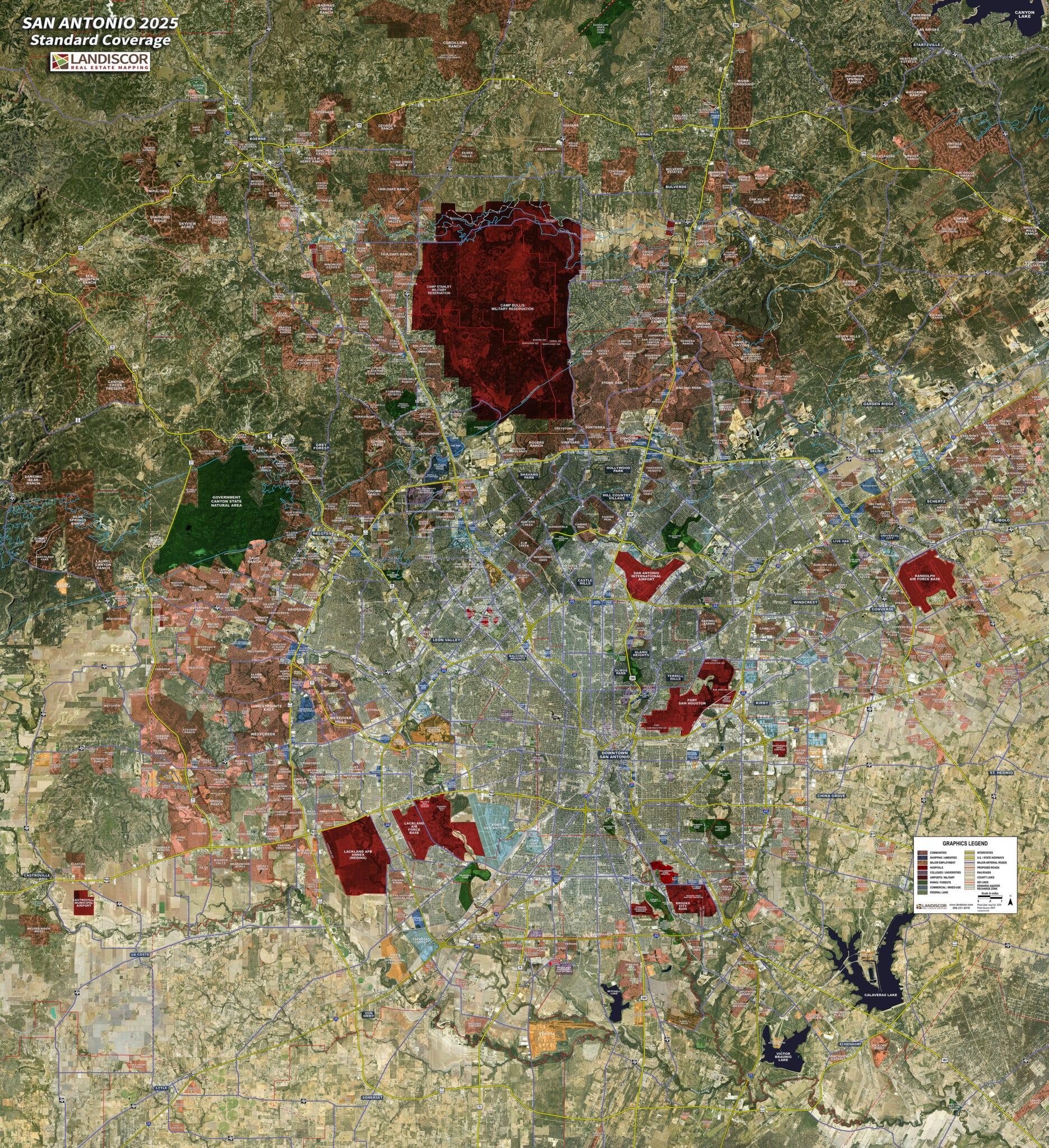
The San Antonio Standard rolled aerial map highlights key market elements using a proprietary GIS model to assist real estate professionals, developers, utilities and governments.