
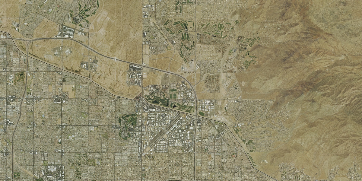
Landiscor’s Aerial Wall Mural Map is a product that has become a staple in thousands of conference rooms around the country. With a citywide overview, the well-recognized aerial wall map serves as a vital tool in determining land use, growth trends, and city planning.
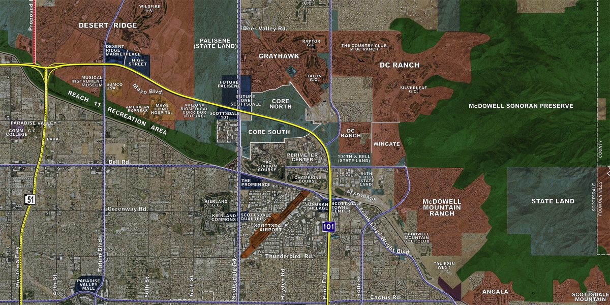
In a single wall-sized display you are able to view your entire metropolitan area with color coded graphical overlays to identify freeways, major roads, railways, municipal boundaries, shopping amenities, parks, golf courses, colleges and universities, state and federal land, master planned communities, and more!
Click on the arrows and drag the bar left or right to view the before and after images.
High-Quality Production Options
• Durst lambda technology for premium quality
• Mounted on ½’’ black gatorboard
• Lamination finish available for dry erase use
• Metal mount backing for magnet use
• P-Trim framing included with each mounted print
• Hanging bar available for Mini murals
• Available in portable rolled versions
• Add custom logos or graphics
Benefits of our Aerial Wall Murals
• Seamless color imagery
• New markets added quarterly
• Off-the-shelf product ready to deliver today
• Custom areas available upon request
• Graphics legend for ease of use
• Nationwide shipping direct to your location
• Various size options for each market
Click on the arrows and drag the bar left or right to view the before and after images.


Please contact us today for more information. Click HERE to search our interactive map for Aerial Wall Maps or Digital Imagery in your area.