
Landiscor’s unique delivery of market information is a function of our proprietary ten-layer market data collection system and proven design aesthetics. This combination allows us to deliver the most visually compelling geographic market data available for any organization involved with local market development, planning or marketing.
Additionally, we can add an eleventh layer – client specific data. This information is embedded into the context of the full information system for powerful impact.
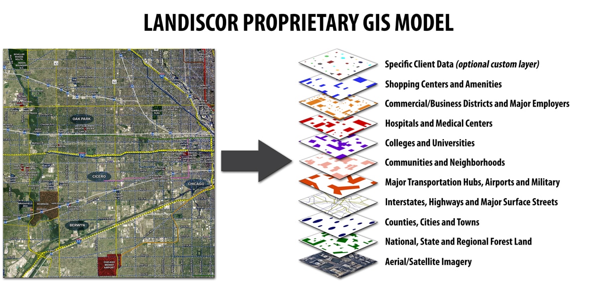
Landiscor is the benchmark solution for aerial mapping market data and presentation. Our proprietary ten-layer information standard delivers a unique visual product that provides our clients with an immediate return on their investment by creating an environment for faster market understanding and improved decision-making.

