
")
")
")


Home / Shop / Washington
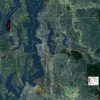
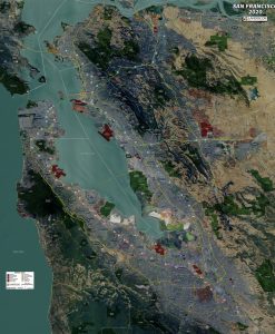
Seattle – Rolled Aerial Map
The 2020 Seattle Rolled Aerial Map highlights hundreds of market data elements including over 80 new and updated features embedded into the industry’s only proprietary GIS model built to assist real estate professionals, developers, utilities, and governments. Use of Landiscor’s 2020 Seattle Rolled Aerial Map will:
- Elevate your market credibility and brand image
- Display compelling visual information for all your meetings
- Demonstrate mastery of local market environments
Market Extents:
– North: Lake Stevens
– South: Spanaway Airport
– East: North Bend
– West: Bremerton
Print Scale:
– Professional: .9” = 1 mile
– Classic: .63” = 1 mile
– Poster: .54” = 1 mile
Delivery:
– Typically 2 weeks from order date
– Professional installation available in select markets