2014 Pinal County Rolled Aerial Map – Poster Print Scale (32.5”x27.5”)
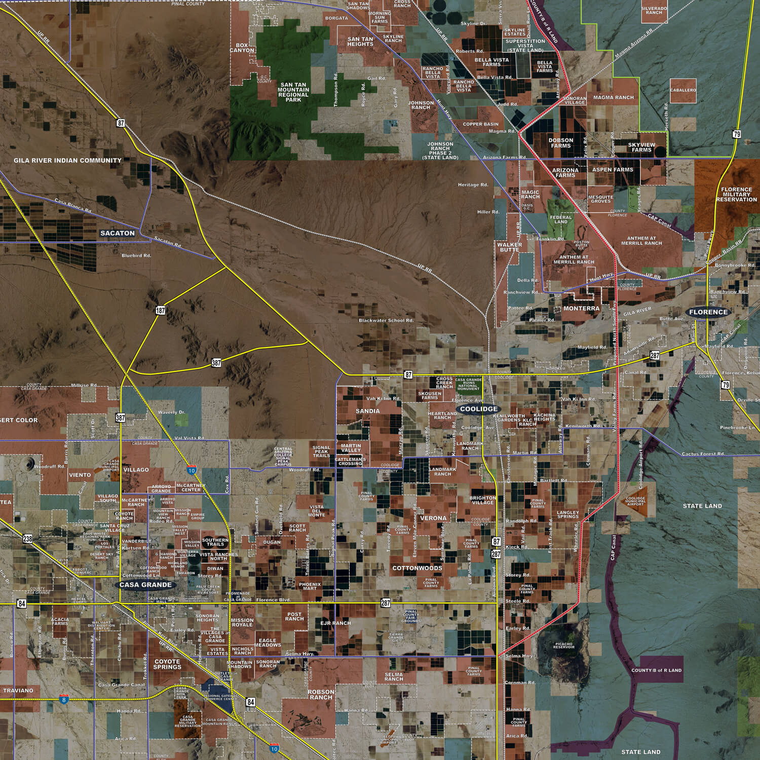
The Pinal County rolled aerial map highlights key market elements using a proprietary GIS model to assist real estate professionals, developers, utilities and governments.